Route: Gorple Lower Reservoir - Reap's Cross - Noah Dale - Hoof Stones Height - Hare Stones - Gorple Stones - Widdop Reservoir
Distance: 9.8 miles
Classification: None
Weather: Cloudy, warm, mostly dry under foot
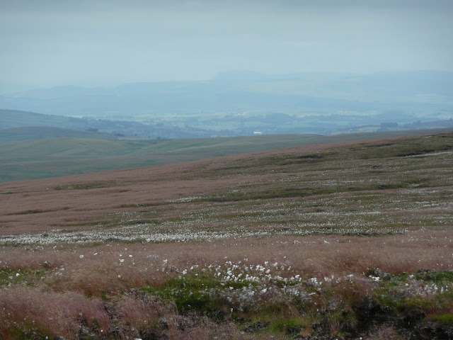
It's difficult to find many words to say about this walk, this is good, honest, featureless moorland. But that's not to say it isn't an enjoyable walk, if it's solitude and peace you require on the hills then Black Hameldon is a good choice.
The walk started at a small lay-by car park near to Gorple Lower Reservoir. I joined the Pennine Bridleway and walked along the dam before joining the Pennine Way, with the intention of taking in the trig at Standing Stone Hill. Unfortunately for me, the path on the OS map from the Pennine Way to the trig has disappeared, so I gave up the ghost and returned to the Pennine Bridleway.
I then turned off the Pennine Bridleway to take in Reap's Cross. The cross dates back to the 1400s and marks an ancient pathway across the Pennines. It was restored in 2002 by local residents having broken in two.
From Reap's Cross I followed a very faint path to Noah Dale which was the beginning of the climb to Black Hameldon's summit, Hoof Stones Height. It didn't take long from here to reach the summit. Something I really enjoyed about this hill is that the views are saved until you are within just seconds of the summit, you have no idea what's in store, no sneak previews, then suddenly you are surrounded by 360 degree views to Pendle Hill, Stoodley Pike, Emley Moor, Boulsworth Hill, the Bowland fells, and on a good day like today even Ingleborough and Pen-y-ghent far to the north.
From the summit I followed the ridge north to Hare Stones and then on to Gorple Stones. Again there isn't much of a path but a fence separating Lancashire and Yorkshire can be used as a handrail here.
Finally the walk takes in Widdop Reservoir, probably the most picturesque part of the walk other than the summit. As said earlier, this is barren moorland, but I personally enjoy this. The higher peaks will attract the hordes in good weather, I'd rather leave them for during the week and take in a good walk like this where you'll be lucky to come across a dozen people all day.
 |


No comments:
Post a Comment